ArcGIS Runtime SDK for iOS: AGSUnit Class Reference
ArcGIS Runtime SDK for iOS  100.9
AGSUnit Class Reference

Description

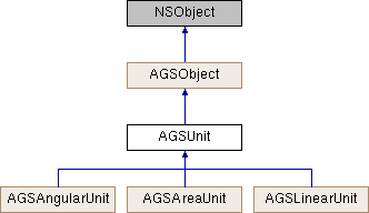
Defines a unit of measurement.

Different types of unit of measurement can be used throughout ArcGIS Runtime. Projected coordinate systems define coordinates using linear measurements, for example using meters or miles, which are represented by AGSLinearUnit. Linear units are also used to return distance measurements, for example by some members of AGSGeometryEngine. Geographic coordinate systems define coordinates using angular measurements, for example using degrees or radians, which are represented by AGSAngularUnit. Methods that calculate the size of areas, for example in acres or square kilometers, use area units. These are represented by AGSAreaUnit. Linear, angular, and area units can be defined by using enumerations of the most common units of measurement. They can also be defined by Well-Known ID (WKID) or Well-Known Text (WKText).

See also
AGSSpatialReference
Since
100
Inheritance diagram for AGSUnit:
AGSObject AGSAngularUnit AGSAreaUnit AGSLinearUnit

Instance Methods

(BOOL) - isEqualToUnit:
 

Properties

NSString * abbreviation
 
NSString * displayName
 
NSString * name
 
NSString * pluralDisplayName
 

Method Documentation

§ isEqualToUnit:()

- (BOOL) isEqualToUnit: (AGSUnit *)  unit

Compares whether two units are equal.

Parameters
unitto compare this one to
Returns
YES if the units are equal
Since
100

Property Documentation

§ abbreviation

- (NSString*) abbreviation
readnonatomiccopy

Abbreviated name of the unit.

Since
100

§ displayName

- (NSString*) displayName
readnonatomiccopy

A user-friendly name of the measurement unit.

Since
100

§ name

- (NSString*) name
readnonatomiccopy

The name of the measurement unit.

Since
100

§ pluralDisplayName

- (NSString*) pluralDisplayName
readnonatomiccopy

A plural form of the user-friendly name.

Since
100